


Map sampling is a collaborative planning tool visualizing social and environmental narratives, inequities and opportunities.


Map Sampling overlays and remixes cultural, social, municipal, infrastructural and ecological geo-data into cartographic provocations.


Map Sampling recontextualizes systems, histories and future projections to be more user-driven, grass roots, holistic and resilient through the dual lenses of community and institutional knowledge. Map sampling appropriates the language of institutional planning to contextualize what communities live everyday and amplify what communities might wish for the future.


Map sampling is currently being utilized in collaboration with GrowHouse to visualize and monitor strategic opportunities and design and network spaces for community resiliency in Central Brooklyn, from both cultural and environmental perspectives, appropriating existing underutilized urban infrastructures and open spaces.
Map Sampling collects data via GIS and on-the-ground monitoring, overlaying & remixing cultural, social, municipal, infrastructural and ecological geo-data into cartographic provocations and interactive open source planning tools. For this project, Map Sampling has determined our project area to have an overlapping confluence of social, climate and pollution crises plus high concentrations of latent green infrastructure, community-led green spaces and rich but undercelebrated cultural history.
Map Sampling and Resilient Roots reciprocally quantify and build opportunities to remediate climate and pollution crises and improve elements of the built public realm. The project illustrates how undermined social quality, environmental resiliency and structural inequity are related, but when leveraged with local participation can incrementally address issues of structural racism, health equity, climate and environment issues, improving the built environment and economic development.


Map Sampling is an ongoing research project and the inaugural project of Ten to One’s nonprofit sister studio, Ten to One For All. Research culminating in the GrowHouse collaboration began with studying New York City-wide urban ecological and social development which revealed socio-spatial inequities and opportunities in Central Brooklyn.


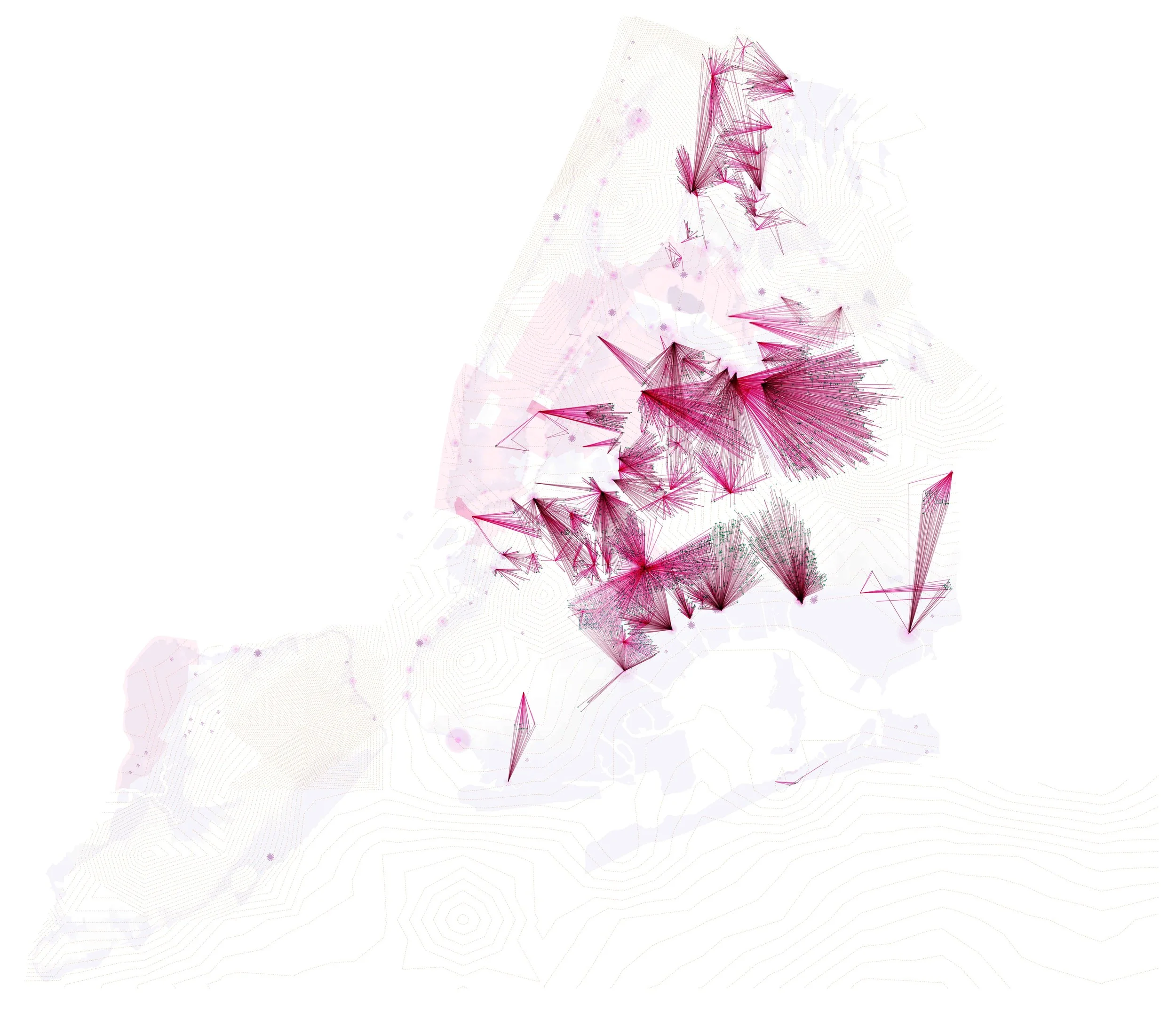
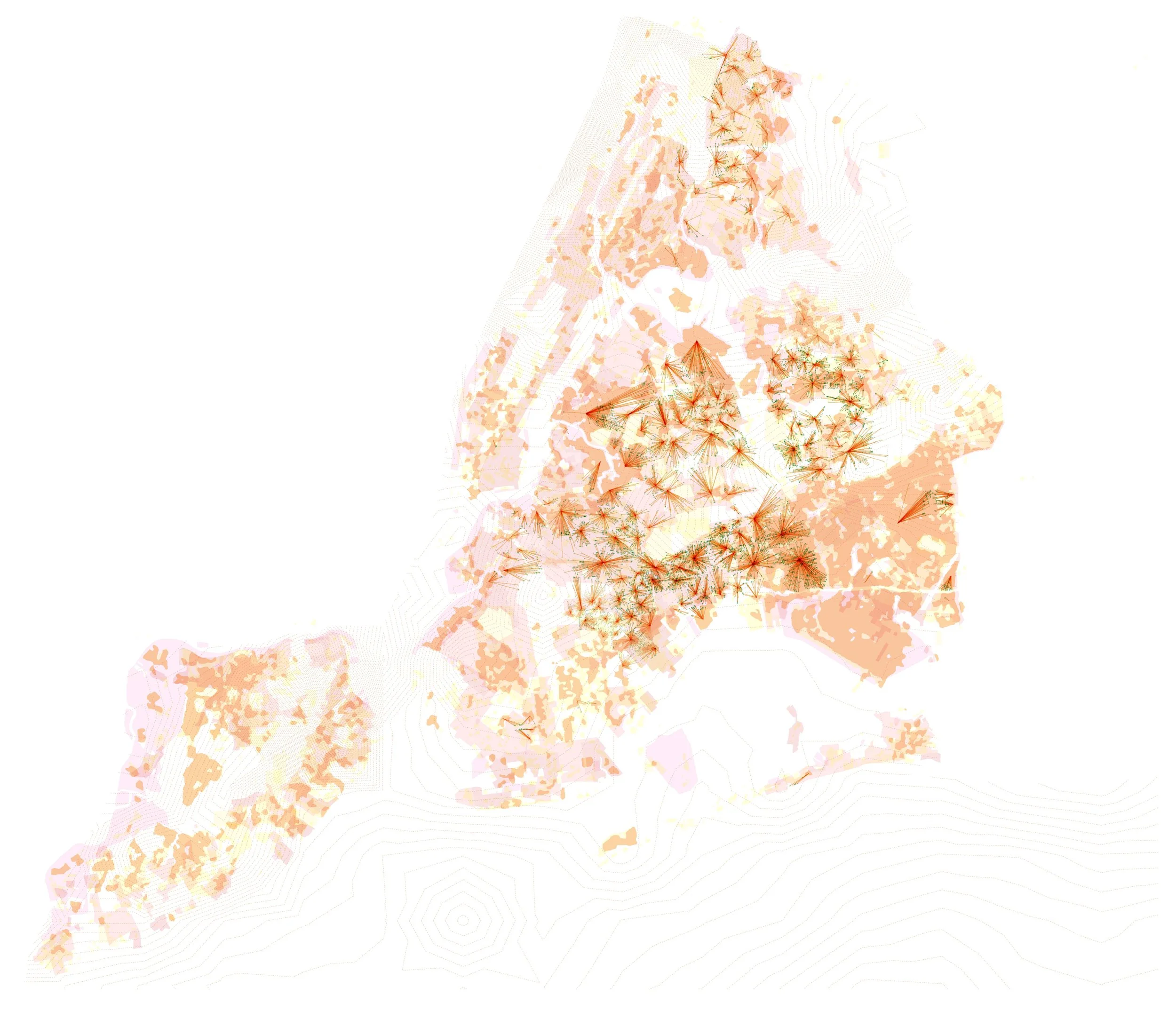
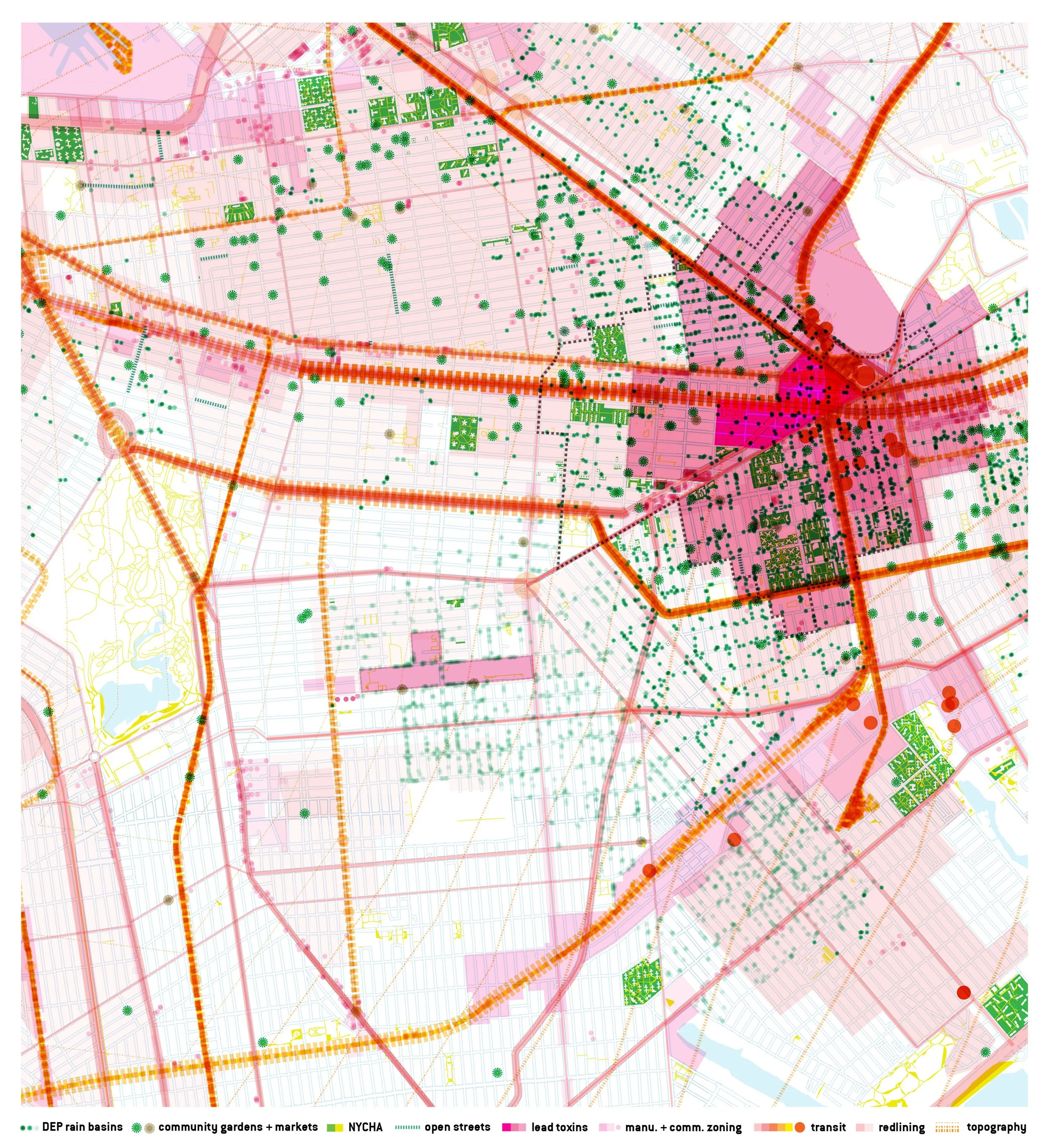
To start, City-wide GIS spatial data is layered of environment climate and pollution crises such as coastal and street flooding both current and projected, heat islands and pollution ie. GHG and lead. Demographic crises indicators are overlayed such as illness and mortality rates, home ownership, home values and loans, income and employment and migration in and out. Systems both current and historical are underlayed such as land-use zoning, urban fabric, urban renewal, redlining, municipal boundaries, transportation, utilities ie. sewage, civic structures, parks, street trees and topography. Overlaying crises and systems reveal hot spots and patterns of inequity and systems of oppression.


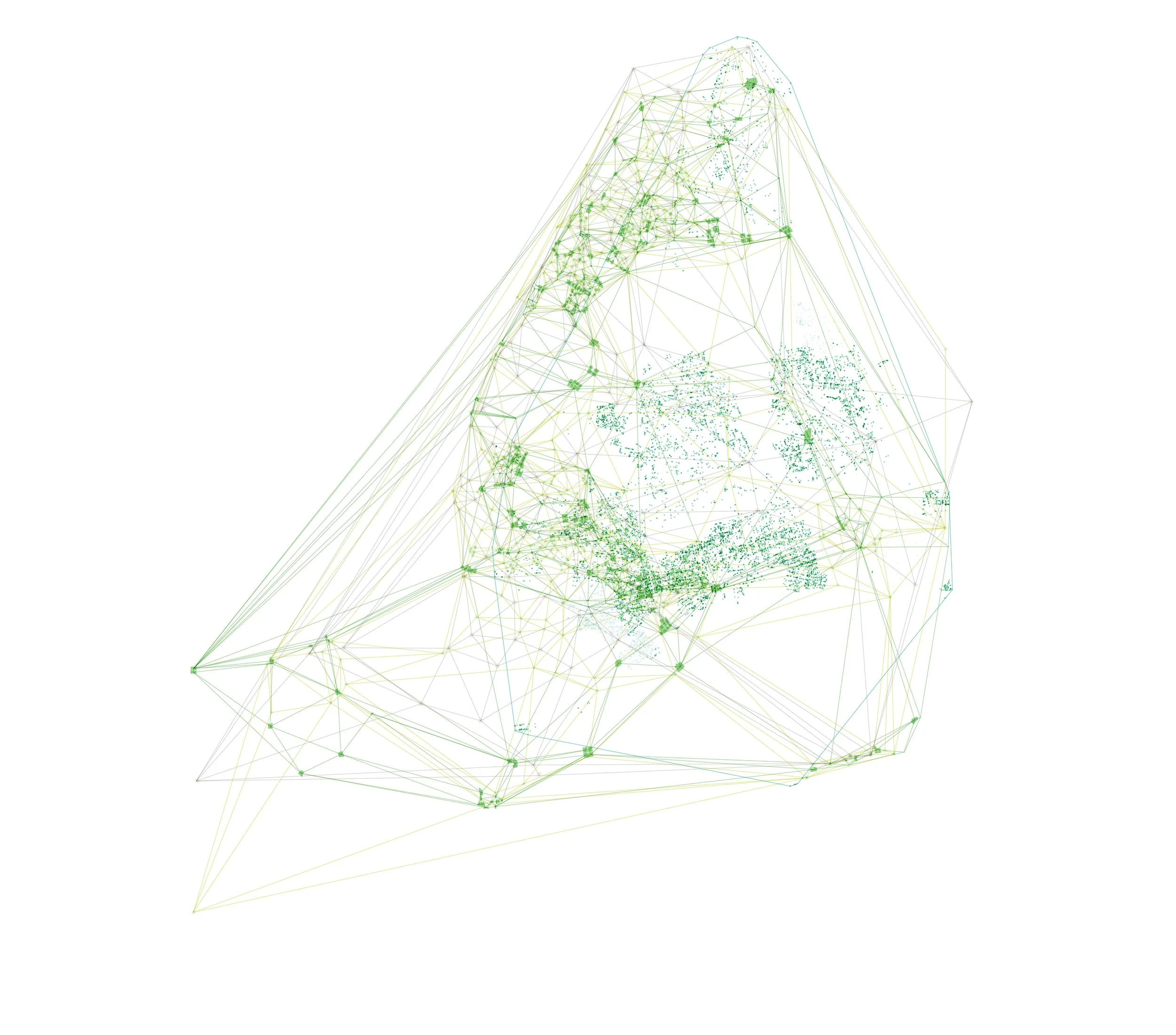
Sampling then layers systems data which presently serves or in an alternate future could be adapted to better serve particular hot spots and crises. Central Brooklyn for instance has a disproportionate abundance of community gardens and farmer’s markets, vacant lots, open space within urban renewal projects, unused infrastructure, Public Right of Way medians and other non-programmed spaces and unfinished green infrastructure projects. Map sampling appropriates the language of institutional planning to narrate what communities live everyday and might propose in a future.


